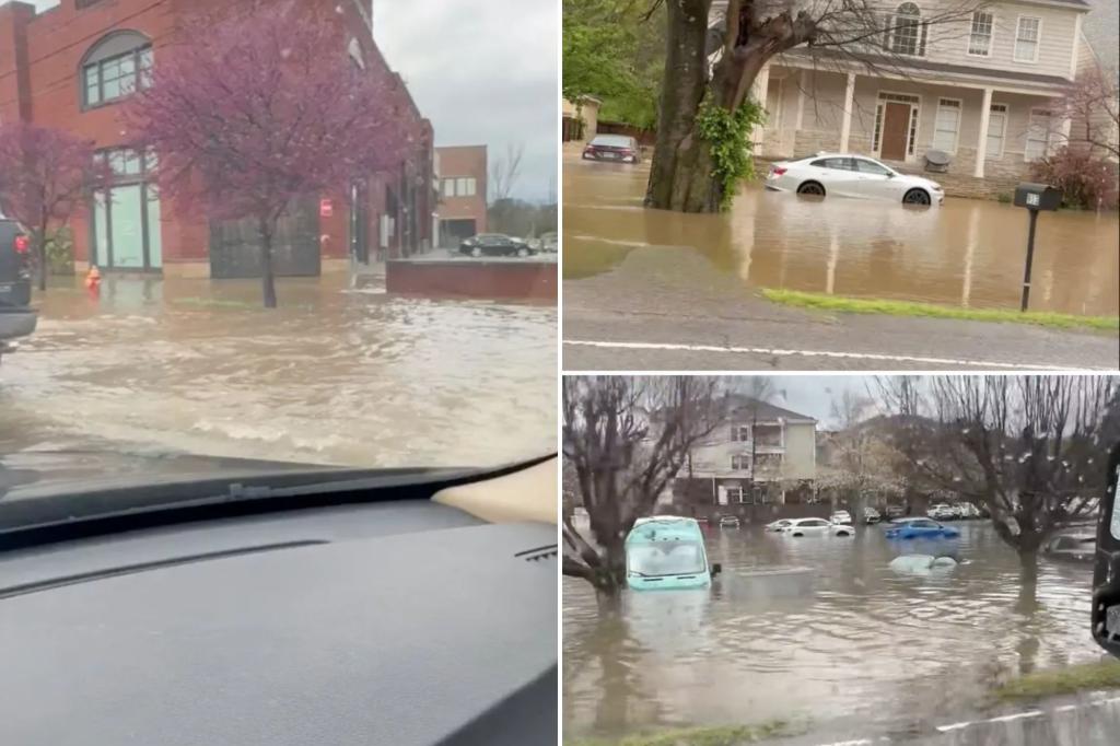
Potentially historic flooding is underway Thursday in the Mississippi and Ohio valleys, as repeated rounds of rain pummel several states in America’s heartland. More than a foot of rain could fall on the region by Sunday.
This is the same part of the country that was devastated by a deadly tornado outbreak Wednesday.
A stalled front draped over the central U.S. will bring continuous rain and storms through the weekend, causing both a flood threat and a severe weather threat.
The National Weather Service offices in Little Rock, Arkansas, and Paducah, Kentucky, have highlighted a particularly dangerous and life-threatening flash flooding situation.
Flooding already happening
Parts of Tennessee and Kentucky have already been inundated ahead of the additional rain that is forecast.
Hopkinsville, Kentucky, was flooded early Friday morning. City officials told FOX Weather that approximately 60% of the downtown was underwater, and a building had collapsed due to the heavy rain. A woman had to be rescued from floodwaters in her home and another from a car.
Hopkinsville City Councilwoman Brittanie Bogard told FOX Weather she hasn’t seen flooding this bad in the city before.
Kentucky Gov. Andy Beshear issued a dire warning during his Thursday news conference.
“It’s the decisions about when to get out, about what to drive through – when to go stay with someone else, that can be the difference between life and death over these next couple of days,” he said.
More than 7 inches of rain fell earlier this week in western Tennessee, and flooding has been reported in Nashville. In the early morning hours of Thursday, cars were seen stuck in floodwaters in South Nashville.
The Nashville Fire Department performed more than a dozen water rescues Tuesday. Due to flooding, numerous roads in the metro area were closed. By Thursday afternoon, creeks and rivers had already overflowed their banks in Memphis.
Nashville and Memphis both recorded daily rain records on Thursday. Nashville more than doubled its daily rain record with 3.8 inches of rain, shattering the old record of 1.5 inches from 1977. This was Music City’s second-wettest April day on record.
Tennessee Gov. Bill Lee urged people to remain vigilant through the weekend and heed guidance from first responders and local officials.
Life-threatening flash flooding threat extends through weekend
NOAA’s Weather Prediction Center issued a Level 4 out of 4 flash flood threat Friday, covering parts of Arkansas, Missouri and Oklahoma.
According to the FOX Forecast Center, models have been indicating rainfall totals of several inches, especially across Arkansas into western Kentucky. That is where 24-hour totals in excess of 5-8 inches could be realized in some places on top of rain that has already fallen.
Flood Watches also remain in place through Sunday for southern Illinois, southern Indiana and Ohio.
The NWS office in Memphis issued this statement on Friday morning: “Total rainfall amounts through Sunday could exceed 10 to 15-inch range along and north of I-40. This is not your average flood risk. Generational flooding with devastating impacts is possible.”
Flood Watches have been issued from northeastern Texas through central Ohio, stretching over 900 miles and affecting over 20 million Americans. The Level 4 out of 4 flash flood threat shifts east and expands Saturday to include the rain-fatigued areas of western Tennessee and western Kentucky.
“Saturday is the day that concerns me the most right now,” said Meteorologist Ryan Husted with the National Weather Service in Nashville. “Because we have time for our atmosphere to recharge, which means we have the potential for dangerous severe thunderstorms once again. In addition, our ground is saturated — that means any rain that falls will run off and it’s going to cause flooding. I’m very confident that Saturday is a dangerous day for flash flooding going into Saturday night.”
Remember, it is never safe to drive through floodwater.
Read the full article here


