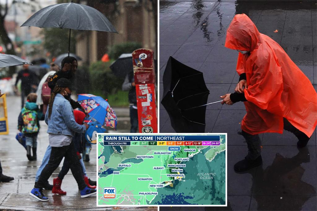
A rare May nor’easter is sweeping across the Northeast on Thursday, bringing a cool, windswept rain to millions hoping to get an early jump on Memorial Day weekend travel.
A nor’easter doesn’t need snow to fall.
It’s simply an area of low pressure with strong northeasterly winds off the Atlantic Ocean.
Two areas of low pressure – one across the interior and another off the mid-Atlantic coast – are causing misery.
The interior low-pressure system already packed a punch in western Pennsylvania on Wednesday evening as a line of severe thunderstorms rolled through the Pittsburgh area, prompting a Tornado Watch and a few radar-indicated Tornado Warnings.
The National Weather Service office in Pittsburgh said crews would be surveying damage in Butler, Washington and Allegheny counties after possible tornadoes on Wednesday.
The NWS said a tornado was already confirmed in Butler after video showed the twister ripping the roof off a salt shed.
Storms also brought some heavy rain that led to flooding in Pittsburgh.
As the rain and wind pick up in intensity on Thursday, impacts will become more widespread.
FOX Weather Meteorologist Britta Merwin was at Smith Point on Long Island in New York on Thursday morning as she was pelted by rain and wind.
“We’ll have breakers about 1 to 3 feet,” Merwin said. “It’s an offshore wind, so of course that’s going to impact the shape of the waves. As we go into this evening, the winds are going to pick up because this is truly just the beginning of our late-season nor’easter.”
The storm’s impacts were felt in New York City earlier Thursday morning.
A video shared from Brooklyn shows rain that was falling during the morning commute.
The coastal low-pressure system has been taking shape south of Long Island in New York.
The low is expected to continue to strengthen and peak in intensity on Thursday afternoon.
It’s expected to bring a steady, sometimes heavy rain from the New York City tri-state area up through New England.
Rain totals are expected to range from 1 to 2 inches, with some locally higher amounts in elevated terrain and along the Northeast and New England coasts.
Flash flooding is also a possibility, and NOAA’s Weather Prediction Center has placed portions of Connecticut, Rhode Island, Massachusetts, New Hampshire and Maine under a Level 1 out of 4 threat.
Wind will also be a problem, especially from eastern Long Island up through the New England coast.
Wind gusts higher than 40 mph are likely, with some gusts expected to exceed 55 mph.
While winds of that strength likely won’t take down too many trees, there could be delays at major airports across the region, especially in Boston.
Wind alerts have been posted for much of the New England coast through Friday morning.
Strong winds could also cause issues at the beach. While astronomical tides are not particularly high, a 1.5- to 2.5-foot water rise is still possible.
If that occurs, minor coastal flooding could be a concern.
Coastal Flood Advisories are also in effect for portions of the Northeast and New England.
In the highest peaks of New Hampshire’s White Mountains, the nor’easter will pull in enough cold air to produce off-season snow accumulation, mainly above 1,500 feet.
The heaviest snow will fall on peaks above 3,000 feet in the Presidential Range, including Mount Washington in New Hampshire.
Read the full article here


