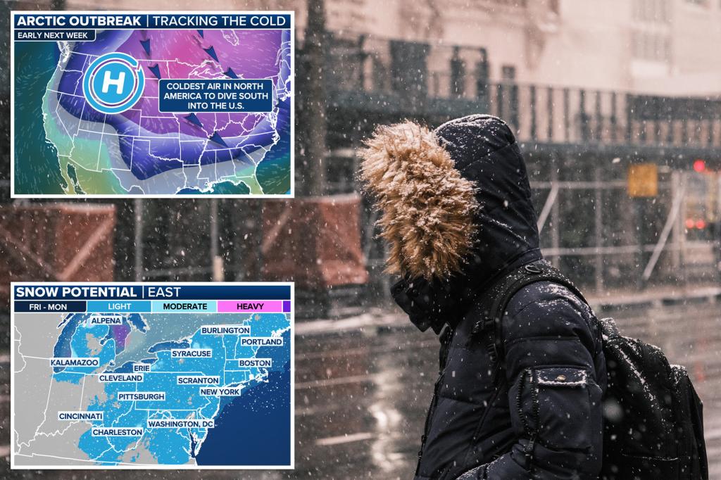
After a brief pause in the arctic air during the end of the workweek, a series of frontal boundaries will help usher in the coldest air of the season, beginning over the weekend and continuing into the upcoming week.
Unlike classic episodes where blizzards and severe weather often form the demarcation line between air masses, the upcoming storm systems aren’t expected to be overly organized when they approach the eastern US, leading to light to occasionally moderate amounts of precipitation.
Between the two storm systems, a maximum of 1-3 inches of snowfall is expected for parts of the Northeast, while 1-3 inches of rainfall is expected in the warm zone over the Southeast.
Where the two forms of precipitation meet in the transition zone, travel is expected to be most problematic, especially in places that aren’t used to the frozen precipitation, such as North Carolina, Virginia and the Delmarva Peninsula.
It is in the mid-Atlantic where ice, especially during the cold mornings, could be the most challenging and lead to difficult travel.
Undoubtedly, the biggest story will be the cold air, not the precipitation, by early next week as the thermometer will approach zero from Chicago and Kansas City through Philadelphia and Boston.
Much of the Southeast won’t be immune from the dangerously cold air as the 20s are expected to reach as far south as the Gulf Coast during the presidential inauguration week.
Warm air accompanies first storm system over the weekend
A brief respite from the cold air will allow most major cities to experience precipitation in liquid form this weekend, from Florida and Georgia through the Interstate 95 corridor in the Northeast.
The heaviest rainfall is expected between I-10 and I-20, with 1-3 inches possible before the weekend ends.
Due to the precipitation’s composition, snowfall is only likely in interior locations of the Northeast, New England and higher elevations, with accumulations generally light, ranging from 1-3 inches.
Following this event, a secondary area of low pressure is expected to form off the coast of the mid-Atlantic, which could prove more significant, particularly for states like Virginia along the I-95 corridor.
Cold air in place for wintry precipitation with second system
Enough cold air will be in place for the second storm system to bring more widespread snowfall when compared to the first, but accumulations are expected to remain light.
The exact location where the center of low pressure forms will be critical in determining who will see snow and who will miss out on any frozen precipitation.
Forecast models continue to suggest that the low-pressure system will not fully develop until it is well offshore, meaning major cities in the East, such as Philadelphia, New York and Boston, will once again miss out on significant snowfall.
That said, wraparound moisture in the mid-Atlantic could cause some travel disruptions in areas that don’t typically see frozen precipitation, such as Virginia, North Carolina and the Delmarva Peninsula.
The impact in these regions is expected to be relatively minor, as the storm system will be moving eastward at a fairly quick pace, but any precipitation that does fall will likely remain on the ground for an extended period as an arctic air mass begins to slide into the area.
Behind the frontal boundaries, low temperatures in Chicago, Cleveland and Boston will approach zero, while cities in the Tennessee Valley will see widespread teens.
Even southern cities like Mobile, Alabama, and Atlanta are expected to see temperatures reach the 20s.
This is a major weather whiplash for the Southeast, which saw snow last Friday and likely temperatures in the 40s and 50s this Friday, ahead of a polar plunge by the end of the weekend.
Read the full article here


